Iceland erupted again this morning at 7:57am Grindavik Time. The eruption was captured in real time. It again is a northwest linear fissure and is located west of Hagafell and a bit south of the prior eruption site in December.
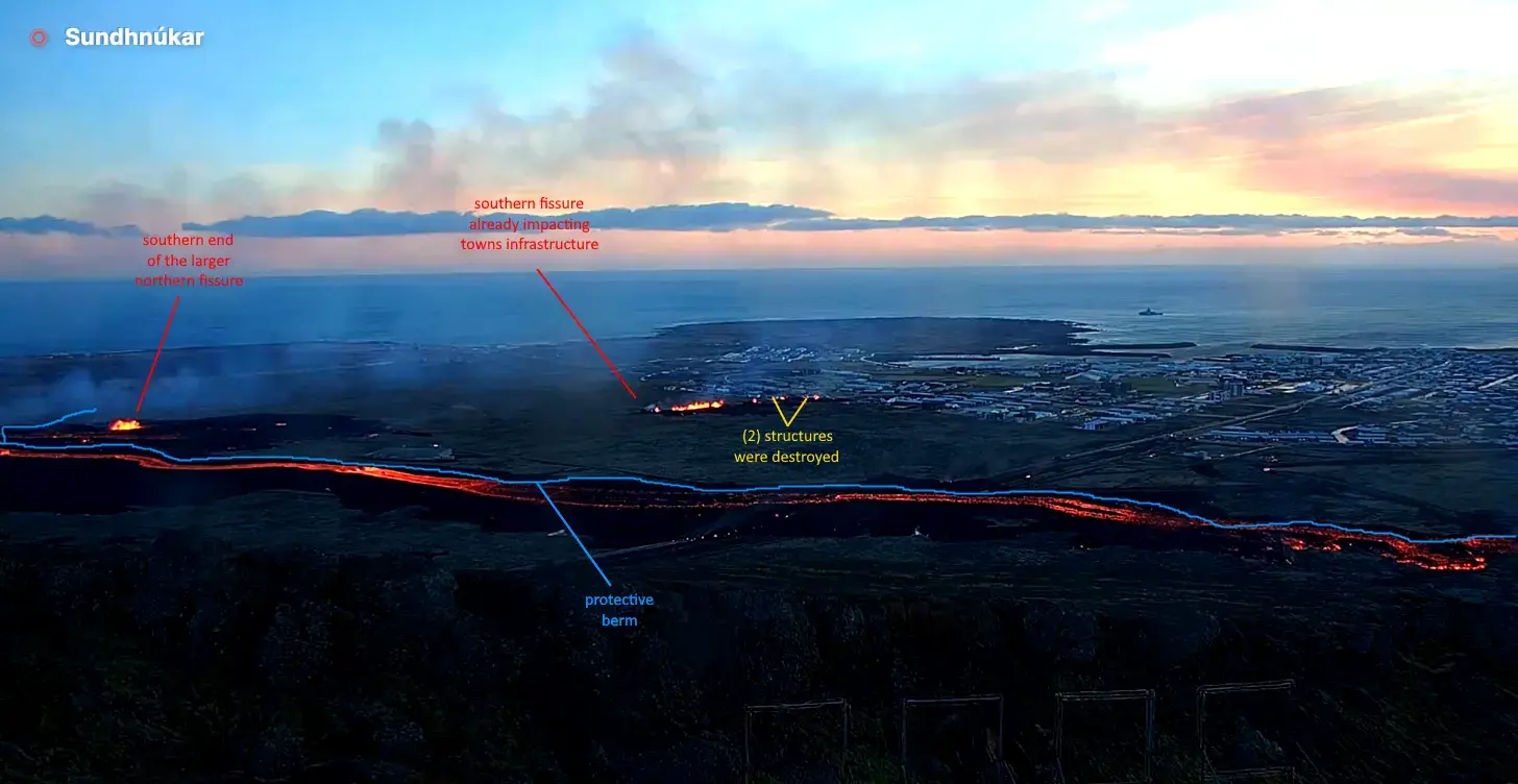
While the locals had built a huge rock berm to protect some of it’s infrastructure, the fissure formed and spread underneath the berm, circumventing its protection. Everyone has been evacuated, though there are reports that despite being told not to bring any previously evacuated animals back to town, some may not have obeyed and now the animals may be locked up and in harms way.
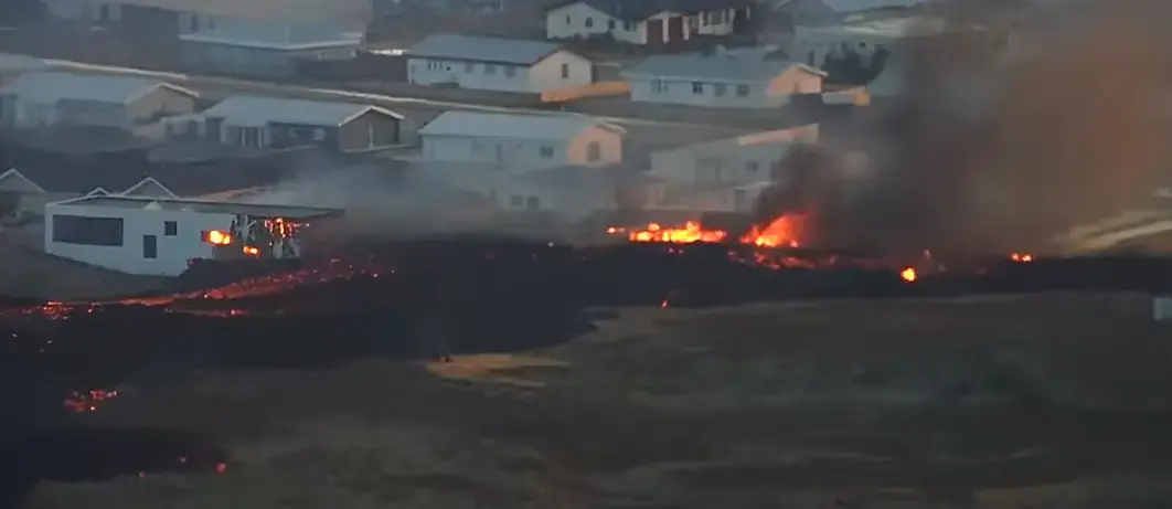
Additionally, a second fissure opened on the north edge of town. You can see this in real time on Professor Shawn Willsey’s live update from early this morning. This southern fissure is much smaller but is much closer to town. It has spewed forth enough lava that it has now contacted and destroyed (2) houses along the towns northern edge. It was one of the worst scenarios that could happen. This is likely just the beginning, and could signal the end of Grindavik as it now exists.
The northern fissure has ejected a huge amount of lava but most was deflected and contained by the berm. It has now breached the berm at the highway, which they plugged as best they could early this morning. All things considered, it was quite wise of them to do this. The greenhouse would likely have been destroyed already, and much more lava would now be heading towards Grindavik, which is downhill from both eruption sites.
.
A closeup of the initial damage from the new active lava flow
.
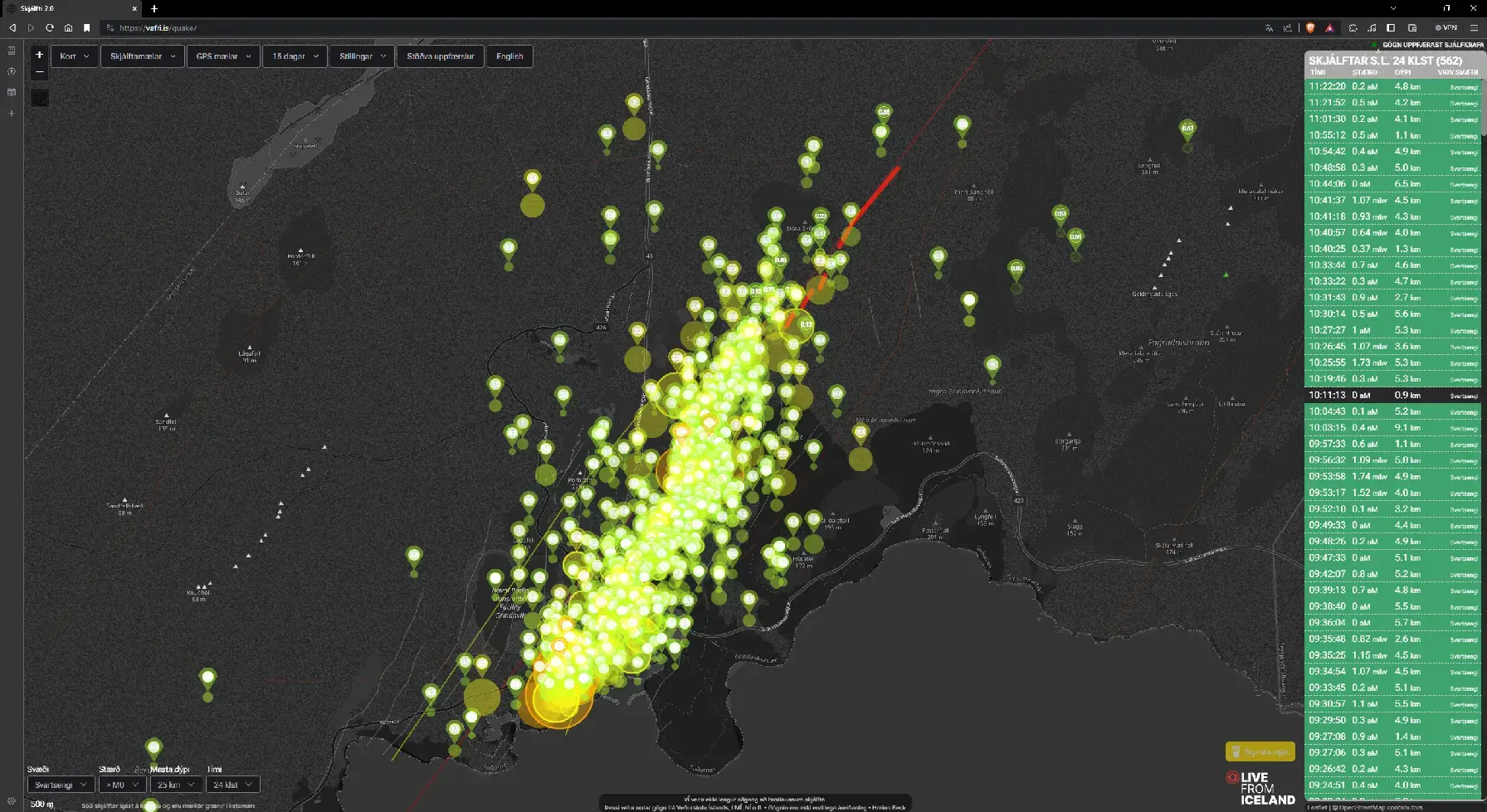
Earthquake map as of this morning. The quakes give you an idea of how big the magma chamber under the town is.
.
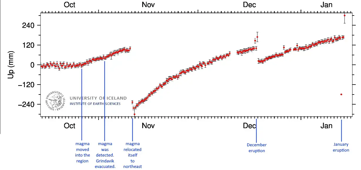
GPS Elevational Data over the campaign of this eruption
.
This is a very serious and dire situation. Whatever god you acknowledge, pray for the town of Grindavik to be spared. My heart goes out to the brave people of Grindavik.


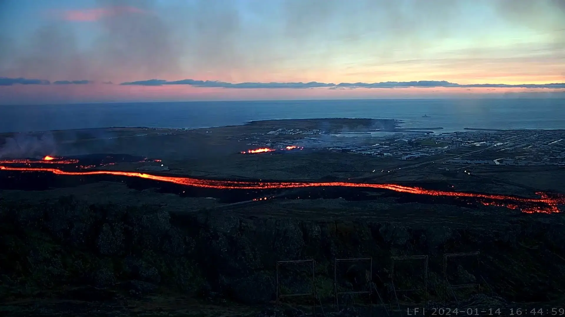
I look at the most recent activity and suspect that either a new fissure has opened in the town proper or the southern fissure has lengthened. There exists a mini cluster of larger earthquakes in this area. The best case scenario is that this is a new structure on fire. All three scenarios are rotten-a-f. It is getting hard to tell due to gasses, smoke and darkness.
That is most likely a RUV news helicopter in the foreground. It’s footage may be available shorty. You can also read their english blog here. Drones are once again banned 4km from town.
There’s a lava flow on the other side of the barrier that was built. It’s inching into the new construction at the edge of the town and has already consumed one house. Probably it will keep going, possibly to the harbor.